
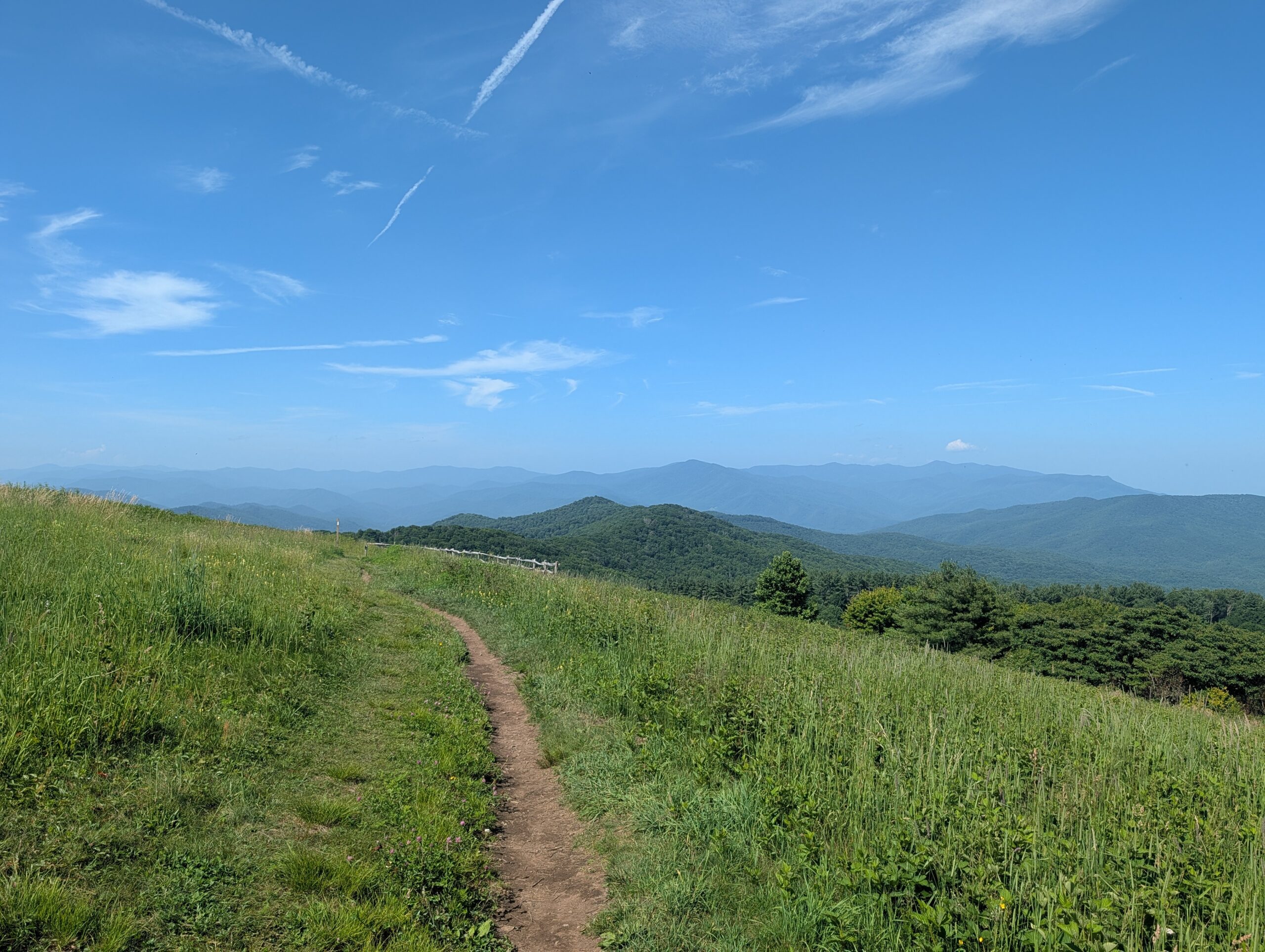
Tucked in Pisgah National Forest, along the mountain-lined border between North Carolina and Tennessee, is Max Patch – a place where the words tranquil, stunning and breathtaking are barely adequate for describing this mountainous masterpiece.
At an elevation of 4,629 feet, this heavenly haven is the home to roaming fields of colorful wild flowers, cheerful songs of golden-winged warblers and radiant sweeping 360 degree views that invite visitors to slow down, breathe deeply and feel connected to the natural world. Looking out over vast vistas, hikers can see layers of hazy blue hues painting the mountaintops, and understand the importance of why this land has been preserved for this moment, and for generations to come.
As you wander through the tall grass and take in the scene around you, it becomes evident that this place has a special, almost sacred, quality that allows visitors to feel at one with nature. While today’s visitors come to Max Patch for its sweeping views and peaceful atmosphere, there is more to this grassy null than meets the eye. Experiences had today at Max Patch are just the latest chapter in a story that stretches back for centuries.
From Forest To Field
In the late 1700’s the location that is currently Max Patch was covered with dense forest which can still be observed around the fields today.
However, in the early 1800s settlers cleared the summit of trees, creating a “cultural bald”. A cultural bald is a treeless, grassy mountain top that is created or maintained by humans. Although the ground is rid of tall trees, settlers maintained the land to be home to shrubberies, long grasses and wildflowers.
So why create a cultural bald at the summit of a mountain? One word: livestock. Max Patch originally served as a prime location for farmers to bring their sheep and cattle to graze, offering sizable space and a calm atmosphere for the animals.
Local legend says that the spot received its name from the farmers that frequented the land with their livestock. One name in particular, “Mac”, evolved into “Mac’s Patch”. However, it is unknown why historic records identify the land as “Max Patch.”
While the origin of the name remains something of a mystery, Max Patch’s next chapter is much better documented. By the 1920s, the quiet grazing land was about to undergo one of the most surprising transformations in its history.
From Pasteurs to Propellers
For nearly a century, the mountain served as a grazing land. Then in the 1920’s – 1930’s Max Patch was transformed into a mountaintop airstrip for thrill-seeking pilots and visitors from across the region. The large open fields allowed for clear visibility, and enough runway, to navigate the take-off and landings of airplanes.
From organized air shows to thrill seeking biplanes, Max Patch was a prime location for pilots, co-pilots and thousands of spectators to visit to experience the electrifying landscape and aviation marvels.
It wasn’t until later in history that this pasture turned plane paradise added a new personality to its identity that aimed at preserving the land for generations to come.
From Airstrip to Appalachian Trail
By the late 20th century. Max Patch faced yet another turning point where its future was uncertain. Private owners of the land had strong considerations of transforming Max Patch into a ski mountain and resort, a development that would have drastically changed the landscape entirely.
Fortunately, those plans never became a reality. Thanks to incredible forethought and vast understanding of Max Patch’s historic and unique story, The U.S. Forest Service purchased 350 acres of Max Patch in 1982 so that the land would be protected, maintained and preserved as a public natural area for future generations.
Just two years later, that decision would shape another important chapter in Max Patch’s story.
In 1984, in partnership with the Appalachian Trail Conservancy and the Carolina Mountain Club, The U.S. Forest Service approved the relocation of the Appalachian Trail to cross through Max Patch.
Today, located on mile marker 255.4, the grassy bald has become one of the trail’s most iconic destinations, offering thru-hikers and day hikers alike a place to pause, soak in panoramic mountain views and recharge before continuing their journey.
The best part? You don’t have to hike all 2,000-plus miles of the Appalachian Trail to experience Max Patch. A short hike to the summit rewards visitors with the same sweeping vistas that have captivated farmers, pilots, conservationists and hikers for generations.
The hike to Max Patch is a 1.4 mile loop and is a moderately strenuous hike. Through continuous conservation efforts, the summit remains cleared of trees and trails are maintained for clear visibility and cleanliness.
The setting is perfect for visitors to bring a picnic to share, and spend a few hours taking in the views. It is also a popular place for photographers to enjoy capturing captivating landscapes and wildlife to enjoy long after their visit to Max Patch is complete.
If you visit, remember that Max Patch is a protected landscape. Staying on designated trails, taking your trash with you while exiting, and respecting wildlife helps preserve its beauty for future generations.
A Legacy Worth Protecting
Whether you come for the history, the hike, the Appalachian Trail, or simply the view, Max Patch has a remarkable way of leaving an impression long after you’ve descended the mountain. It reminds us that landscapes can evolve from different chapters and experiences without losing their soul, and that preserving places like this ensures future generations will experience the same sense of wonder.
On a clear day, as the clouds drift lazily over the Blue Ridge Mountains and the grasses sway beneath your feet, it’s easy to believe you’ve found one of the most peaceful places in Appalachia. Perhaps that’s why Max Patch has earned its nickname as the “Crown Jewel of the Appalachian Trail”—not because it stands above the rest, but because it invites everyone who visits to see the world from a little higher, breathe a little deeper, and take memories home from this wondrous piece of Appalachia.
No responses yet